
"Harry, I have no idea where this will lead us, but I have a definite feeling it will be a place both wonderful and strange."
-- Federal Bureau of Investigation Special Agent Dale Cooper, Twin Peaks
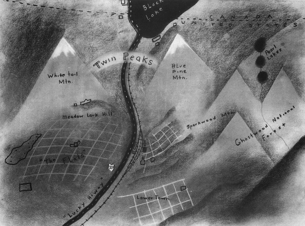
The website Big Think has taken us back to the creation of the classic ABC television series Twin Peaks by examining the original map that co-creator David Lynch drew up in order to help sell ABC executives on the series. The moody artwork captures the tone of the series, referencing some familiar names such as Sparkwood ("Sparkwood and 21" was the intersection where murder victim Laura Palmer jumps off James Hurley's bike late and night and runs into the woods), Pearl Lakes (where Leland Palmer said he first encountered the demon spirit BOB) and Ghostwood National Forest (home to the pine weasel species used by Benjamin Horne in order to stop the Ghostwood Estates development project).
Other names like Lower Town, Meadow Lark Hill and The Flats are never mentioned in the series, while the "Lucky Hiway" is labeled 21 and is probably Washington State Route 21. More detailed maps of the fictional town of Twin Peaks can be found in Welcome to Twin Peaks: An Access Guide to the Town, published in 1991 by Pocket Books. Essentially a parody of a traveller's guide book, it also includes a history of the Native Americans around the area, background on the Packard Sawmill, and a list of songs on the jukebox at the Double-R Diner. For a more detailed analysis of the original map, though, check out the Big Think page at the link above.
No comments:
Post a Comment